The 2022 Eruption of Mauna Loa
Mauna Loa Solar Observatory (MLSO) closed Monday, Nov 28, 2022 due to the volcanic eruption of Mauna Loa. The eruption ended on Dec 13. Lava destroyed at least a mile of the Mauna Loa access road and power lines at approximately 10,000 ft. elevation. The site is without power and inaccessible except by helicopter. NOAA and MLSO site manager Ben Berkey confirmed that the site had very little to no ash and there is no damage to the facility. Roadwork will begin when the lava has cooled enough for crews to safely begin new construction; expected completion date is June 2024.
This page is the archive of update posts. Latest update: October 18, 2023. For general up-to-date USGS information, see the USGS Volcano Update Page.
-
11/28/2022 morning:
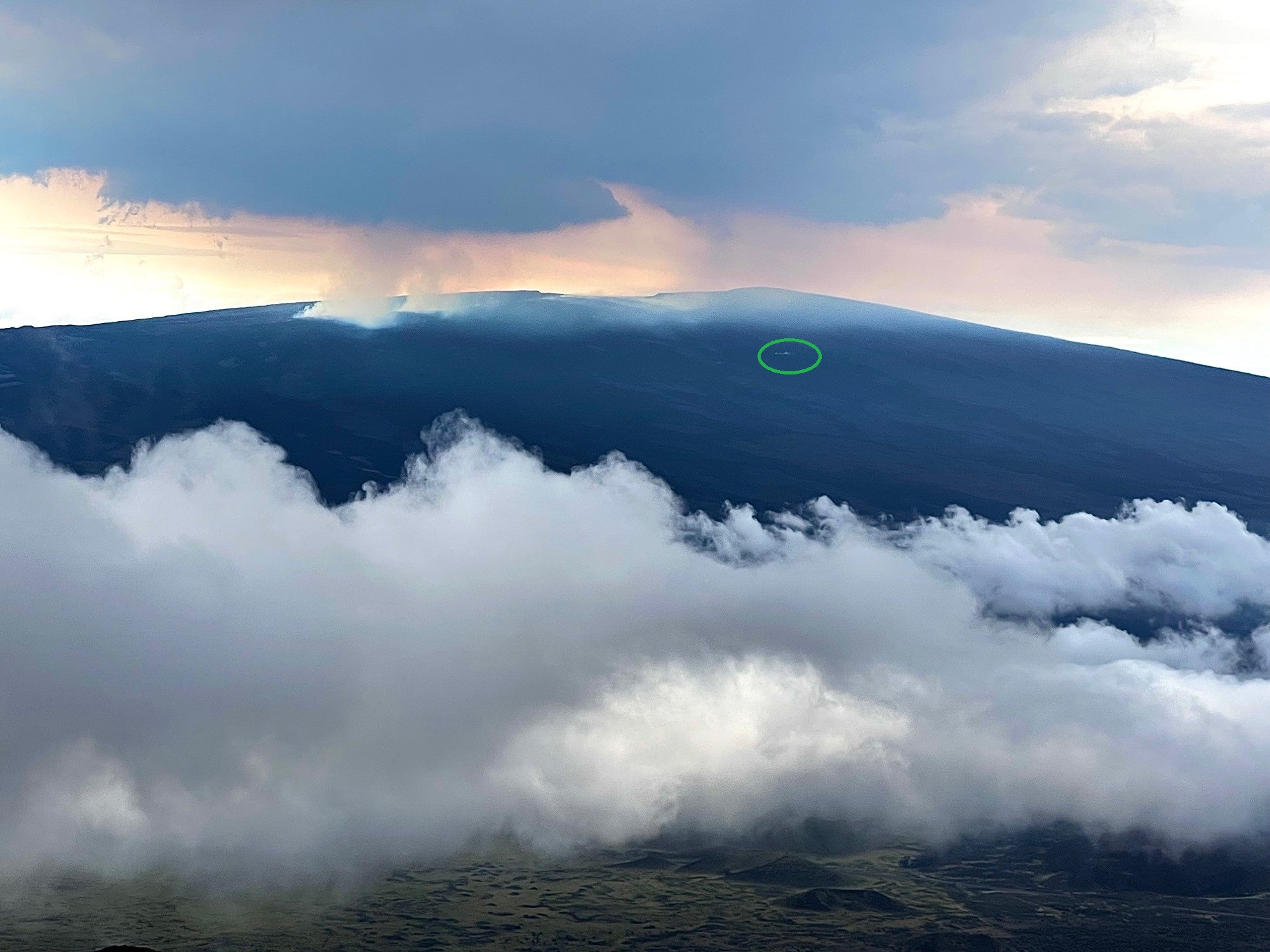 Image of Mauna Loa from Mauna Kea showing the eruption sites and MLSO location (green circle) at 9:00 AM local time (HST)
 - 11/29/2022: The Mauna Loa site is currently without power. We are uncertain on the status of the access road.
-
11/29/2022 morning:
The eruption was calming down over the afternoon, with new overnight photos or updates from USGS and summit webcams showing a cooling summit lava lake. But the volcano was reorganizing into a northeast flank eruption during this time. By Nov 28 1:30 PM, one of these fissures erupted into a large lava flow that started proceeding down toward our access road and power lines. At about 4:30 PM on Nov 28 this lava flow had crossed, cutting off power to the site. By 7 PM Nov 28, the backup power supplies for the data network had gone offline, so for all practical purposes, the site is offline.
At this point, we do not expect to have NCAR staff on the mountain again until well after the lava flow has stopped and a new road surface can be created. We will require the power company to replace poles or install a large generator somewhere on the mountain before we can get back to taking data.
As for sunrise this morning, Nov 29, this lava flow continued to pass the Mauna Loa access road (approximate position is shown in yellow in the photo provided) and has proceeded down to about 8,000 feet, just missing the Hi-Seas (https://www.hi-seas.org) Mars Habit circled in green.
The eruption is now falling into the path taken by the 1970s and 1980s eruptions. So without significant changes to plumbing feeding the lava flows, we can expect the flows to continue toward the Saddle road before eventually turning east when the slope levels out and heading toward Hilo. With this shallower terrain, it will likely be days or weeks before roads or structures can be threaded either along Saddle road or in Hilo itself.
The good news for the observatory is that for most historic flows it seems like once the eruption gets established in the northeast flank, it stays on the northeast flank, so the MLSO/MLO site should be fine, and we should be able to get back up there to take more data within a few weeks after the end of the eruption.
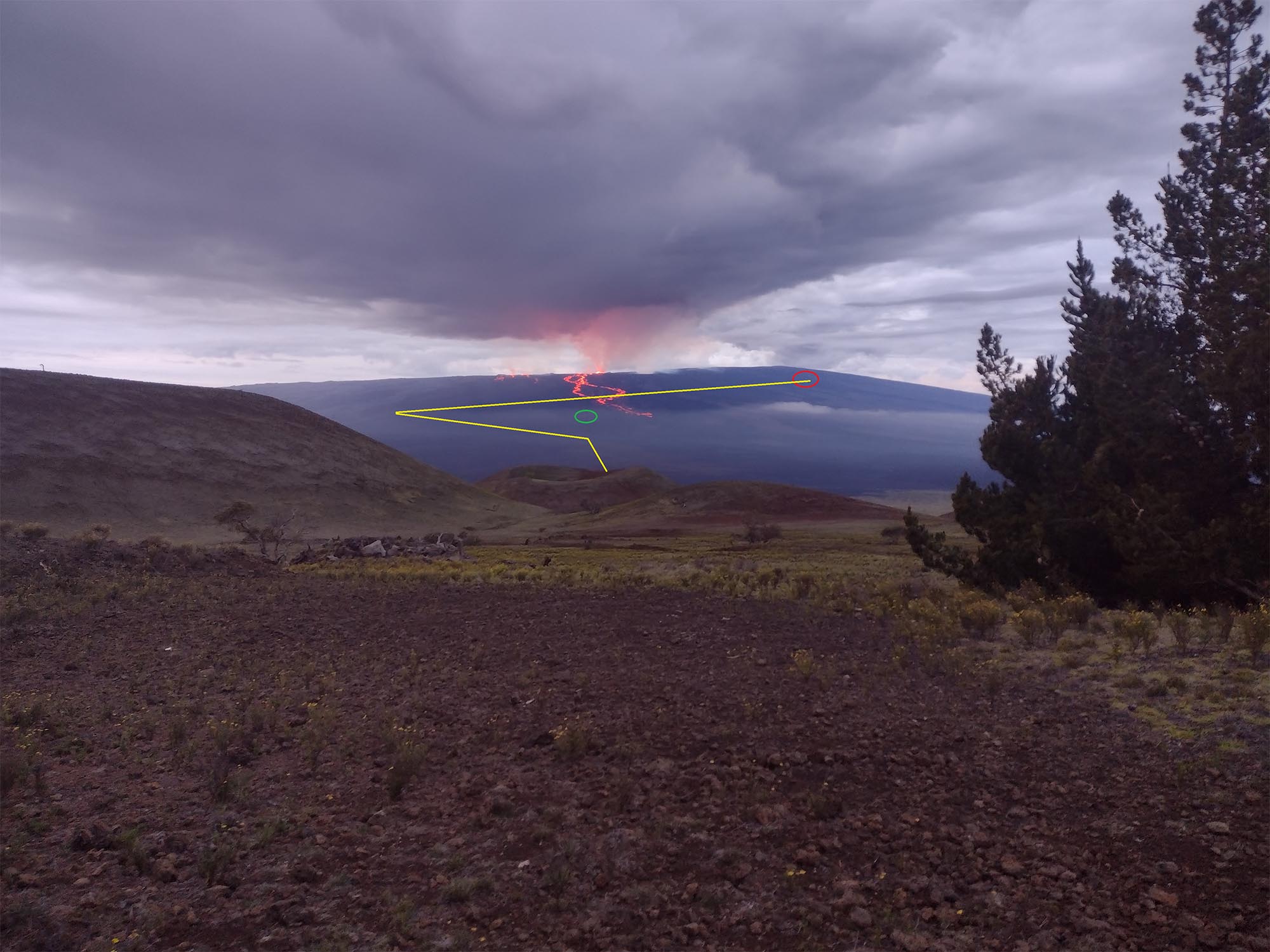 Image of Mauna Loa from Mauna Kea showing lava flows, and annotated with path of Mauna Loa access road (yellow) to MLSO (red circle) and site of Hi-Seas Mars Habitat (green circle)
 -
11/29/2022 evening:
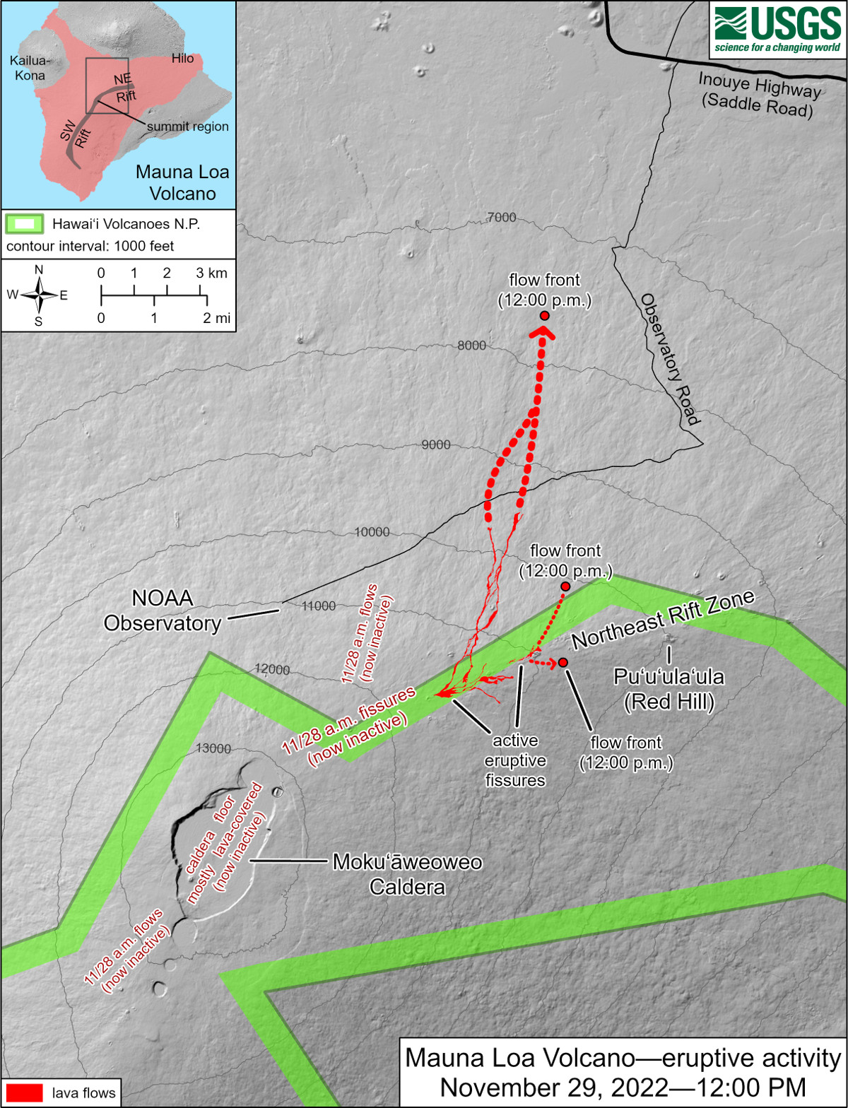 USGS map showing lava flow across the access road (note that 'NOAA Observatory' is same site as MLSO)
 -
12/1/2022 morning:
Another lava flow (fissure 4) crossed the Mauna Loa access road (see map below). This flow also has a small lobe that is moving east from the main flow. The larger lava flow (fissure 3) continues to move downslope, slowing and spreading as it gets to flatter terrain. As of 7 AM Hawaii time it was 3.4 miles from the Saddle Road. Note in map that 'NOAA Observatory' is same site as MLSO.
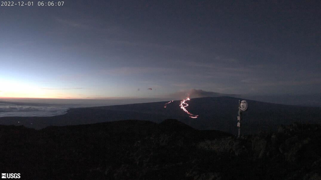 USGS webcam image from Dec 1 at 06:06 AM Hawaii time from Mauna Kea shows the lava flows continuing in the northeast rift zone on Mauna Loa flowing downslope toward the Saddle Road.
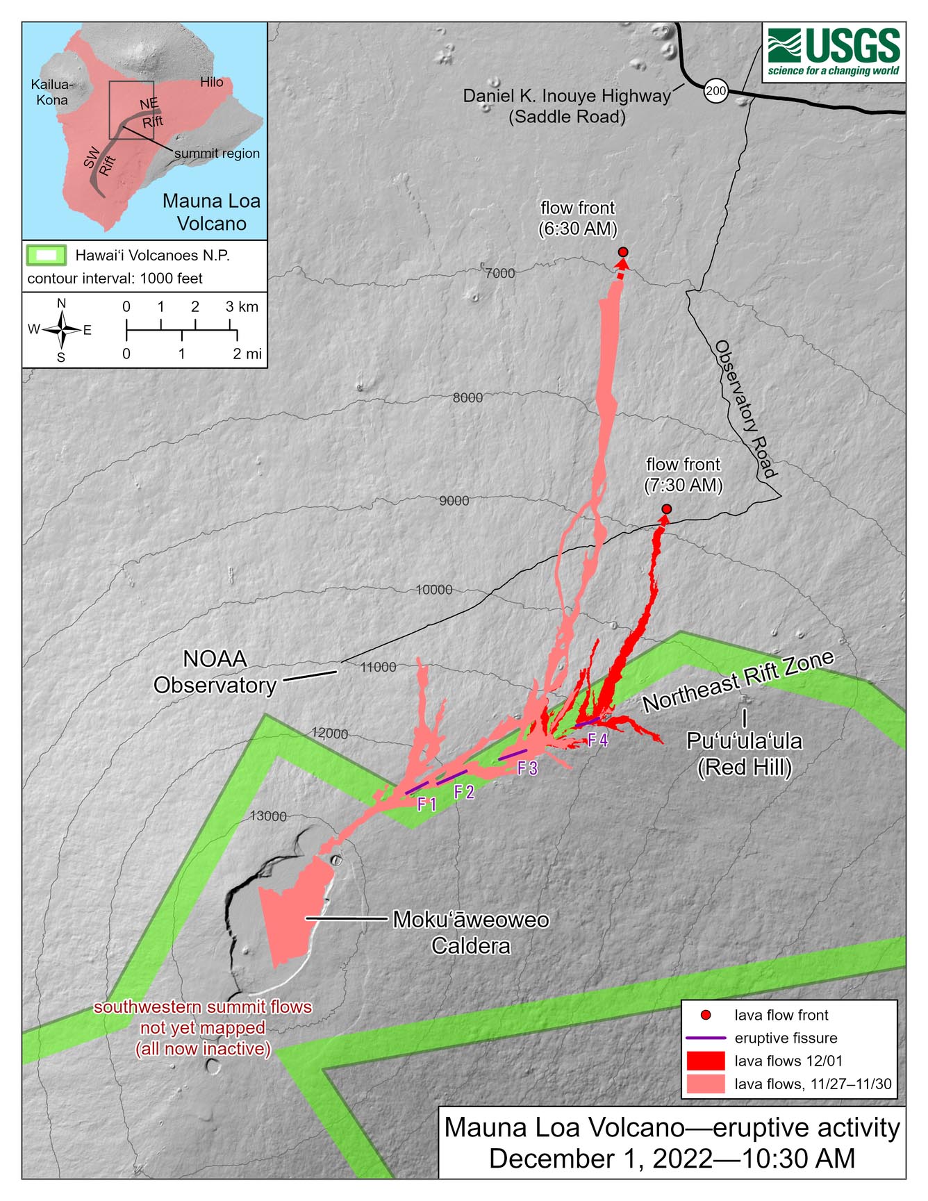 Map of lava flow (fissure 4) showing where it crossed the Mauna Loa access road (note in map that 'NOAA Observatory' is same site as MLSO
 -
12/1/2022:
These images show the extent of the damage to the upper part of the Mauna Loa access road. Lava continues to head downslope to the Saddle Road and is spreading out as it reaches the flatter terrain. If flows continue they could damage the Mauna Loa access road near the Saddle Road, and very importantly, the Saddle Road itself
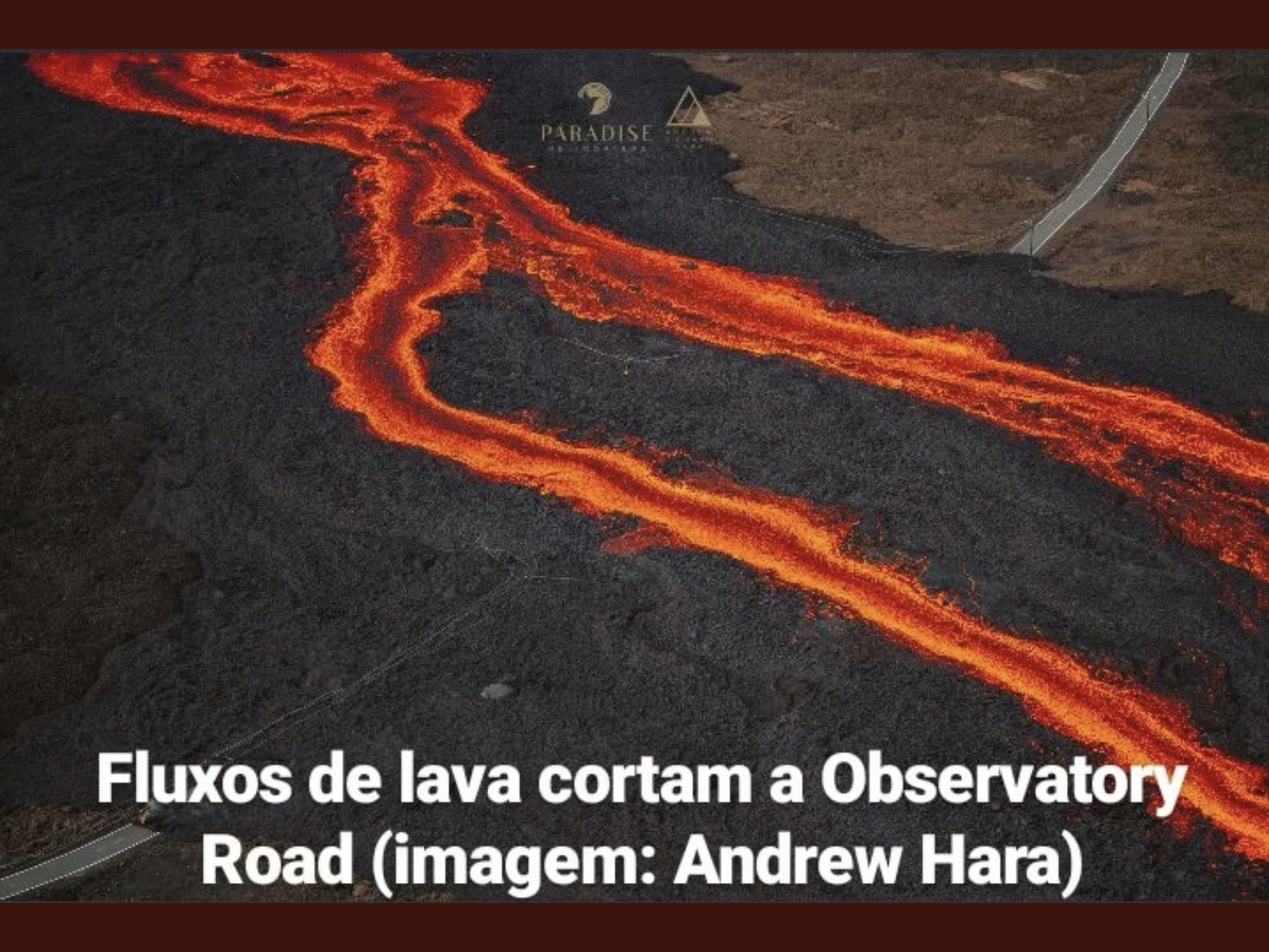 Lava flow over Mauna Loa access road (image courtesy of: Paradise Helicopter Tours and Andrew Hara)
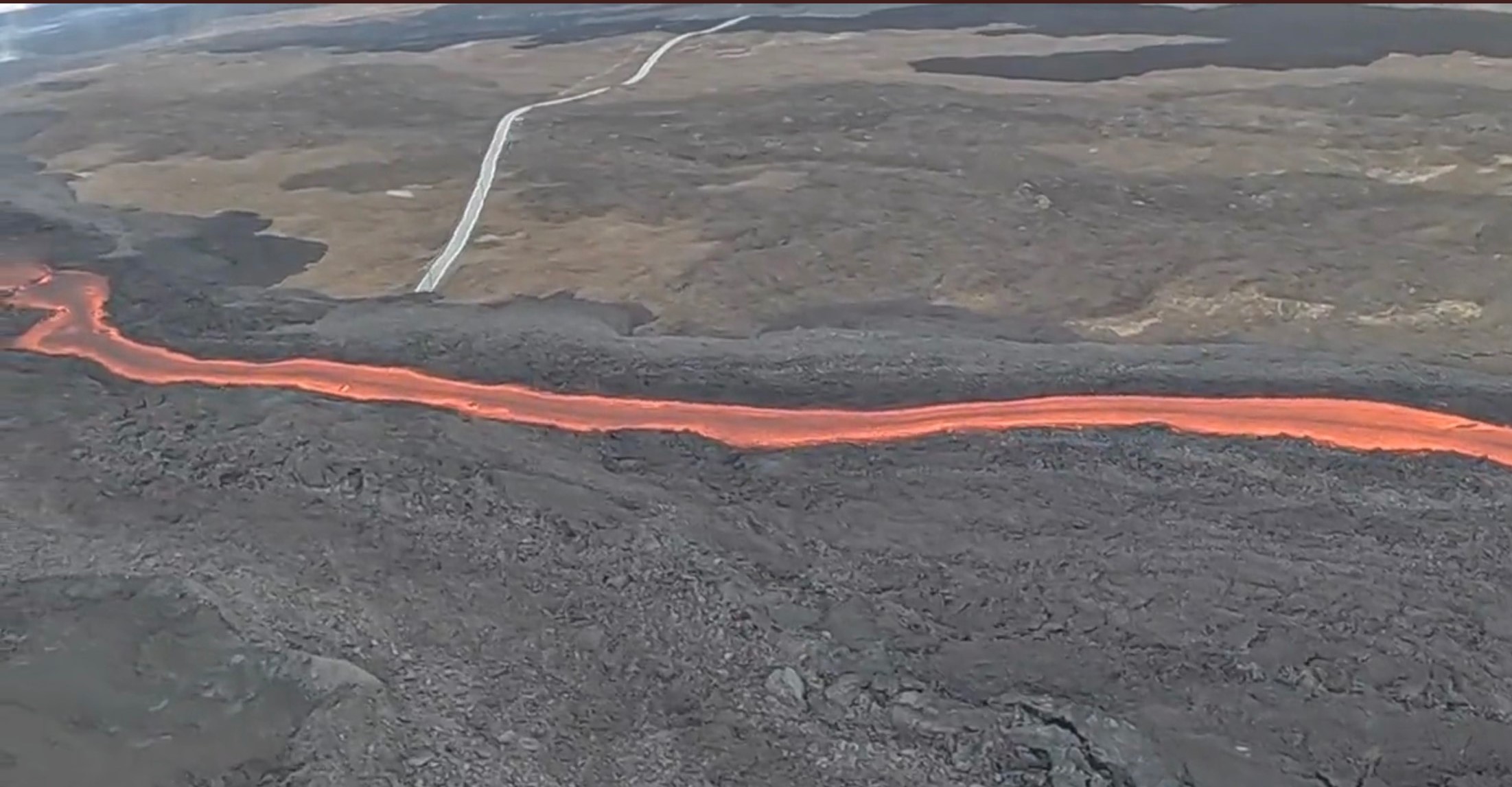 Lava flow over Mauna Loa access road (image courtesy of: Paradise Helicopter Tours and Andrew Hara)
 -
12/2/2022 morning:
The small lobe that was moving to the east from fissure 4 has stalled. Volcanic gas plumes are lofting high and vertically into the atmosphere. Fissure 3 remains the largest lava flow traveling slowly toward the Daniel K. Inouye Highway (Saddle Road). USGS monitoring detects tremor (high rates of earthquakes) in the location of these fissures indicating magma is still being supplied. Activity is likely to continue as long as USGS see this signal.
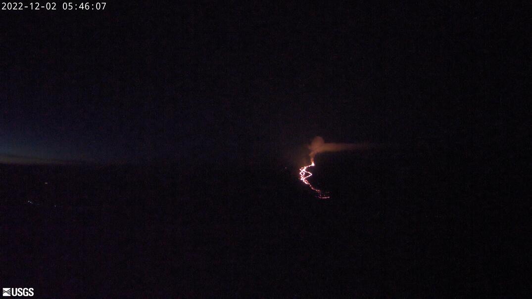 Fissure 4 is still active with lava flows moving toward the northeast
 -
12/4/2022 morning:
Alert level has dropped to Orange, from Red, since the threat to aviation of significant volcanic ash emission into the atmosphere has passed. Ground-based alert remains at 'WARNING' due to continued flow of lava in fissure 3 which is moving very slowly toward the Daniel K. Inouye Highway (Saddle Rd). At noon Dec 4 the lava was 2.25 miles from the road. Fissure 3 is the only active fissure.
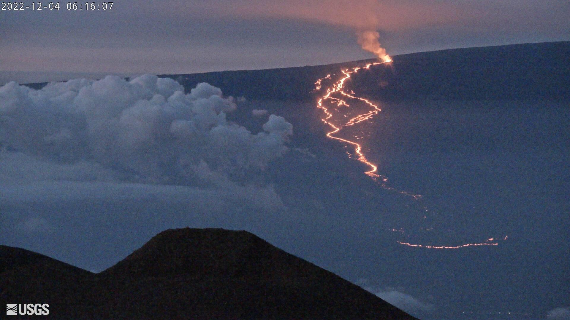 View of Mauna Loa from Mauna Kea at 6:16 AM HST
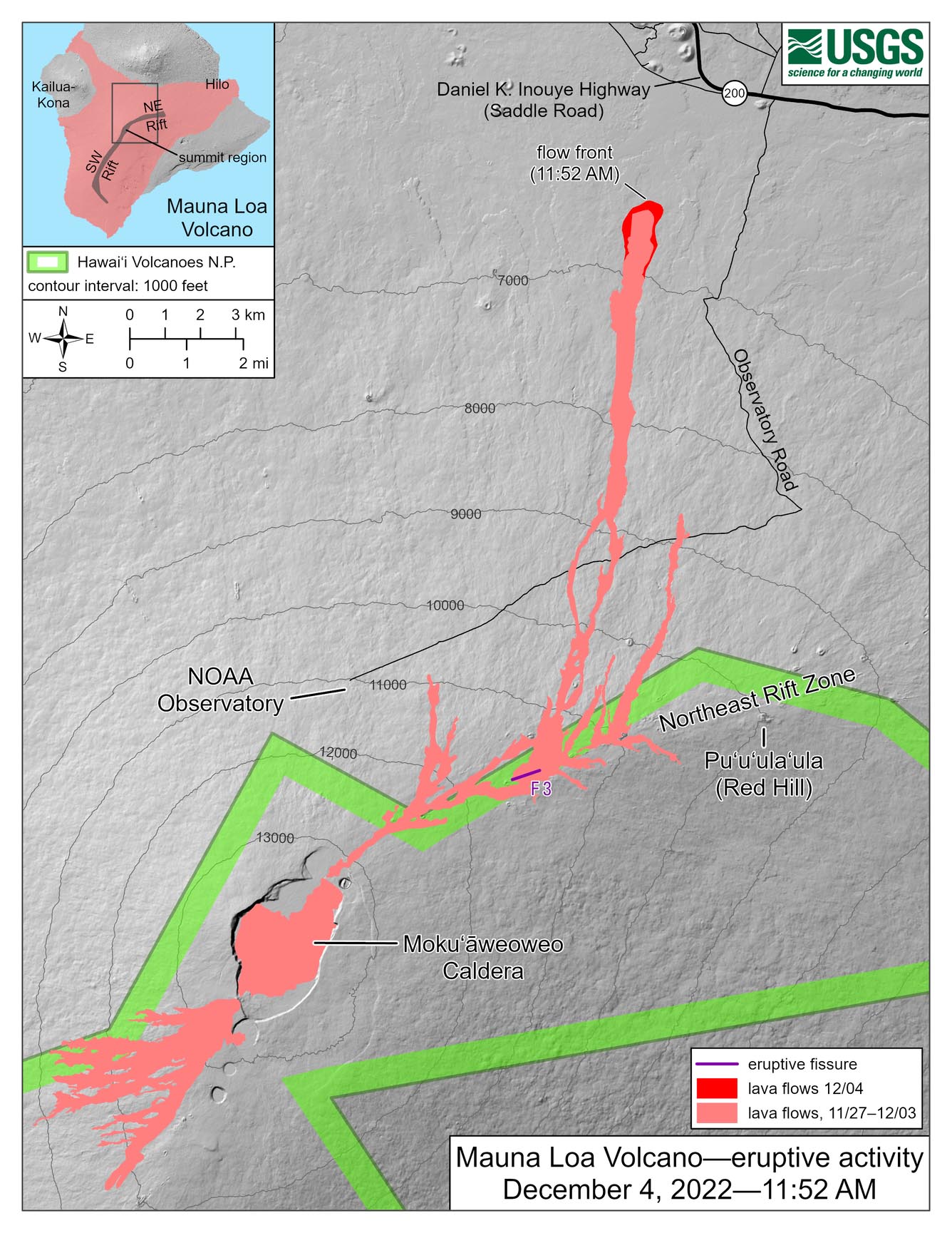 Map of lava flows at 11:52 AM HST
 -
12/8/2022:
Fissure 3 remains the only active fissure. The supply of lava was reduced this morning. Lava was overtopping channels near the vent with flows extending no farther than 2.75 mi (4.4 km) from the vent as of 9:30 a.m. December 8. The channels below this point appear drained of lava and probably no longer feed the main flow front, which remains stalled about 1.7 mi (2.8 km) from the Daniel K. Inouye Highway (Saddle Road). The lava flow is now inactive for most of its lower length, but the flow front may appear to advance a little as it settles.
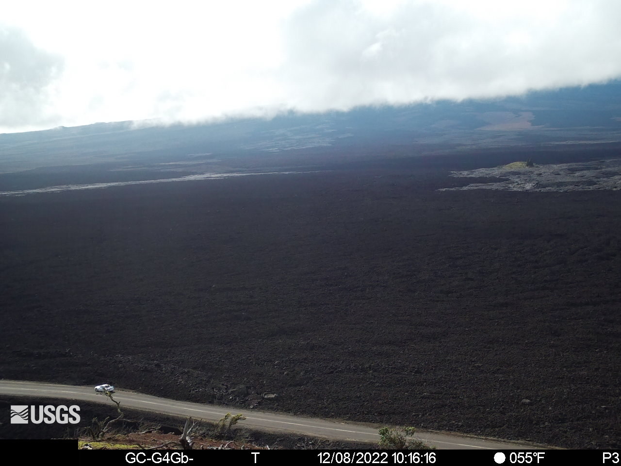 View of Mauna Loa from Mauna Kea at 10:16 AM HST
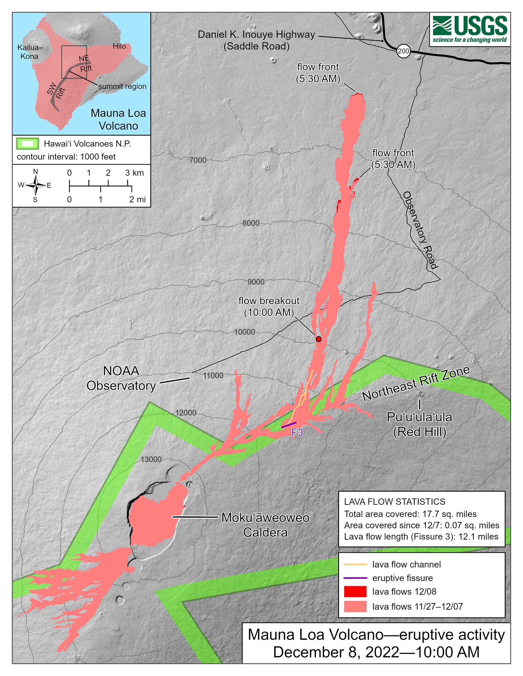 Map of lava flows at 7:00 AM HST
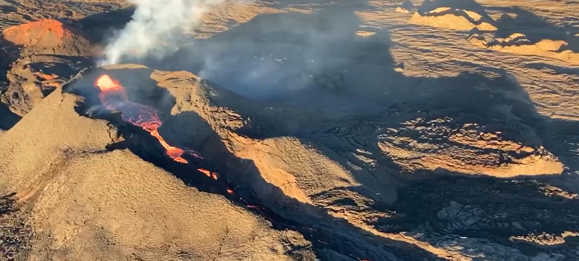 View of Mauna Loa from above showing lava
 -
12/10/2022:
USGS reports today that most of the lava from fissure 3 is confined to the vent in a small pond. The lava flow approaching the Saddle Road has stagnated and is no longer a threat. Based on past behavior, USGS assessment is that high eruption rates will not resume, and the eruption may end soon. USGS cautions there is still an inflationary trend of the Mauna Loa summit and there remains a small possibility that an eruption could continue at very low rates. USGS has reduced the volcano alert level from 'warning' to 'watch'.
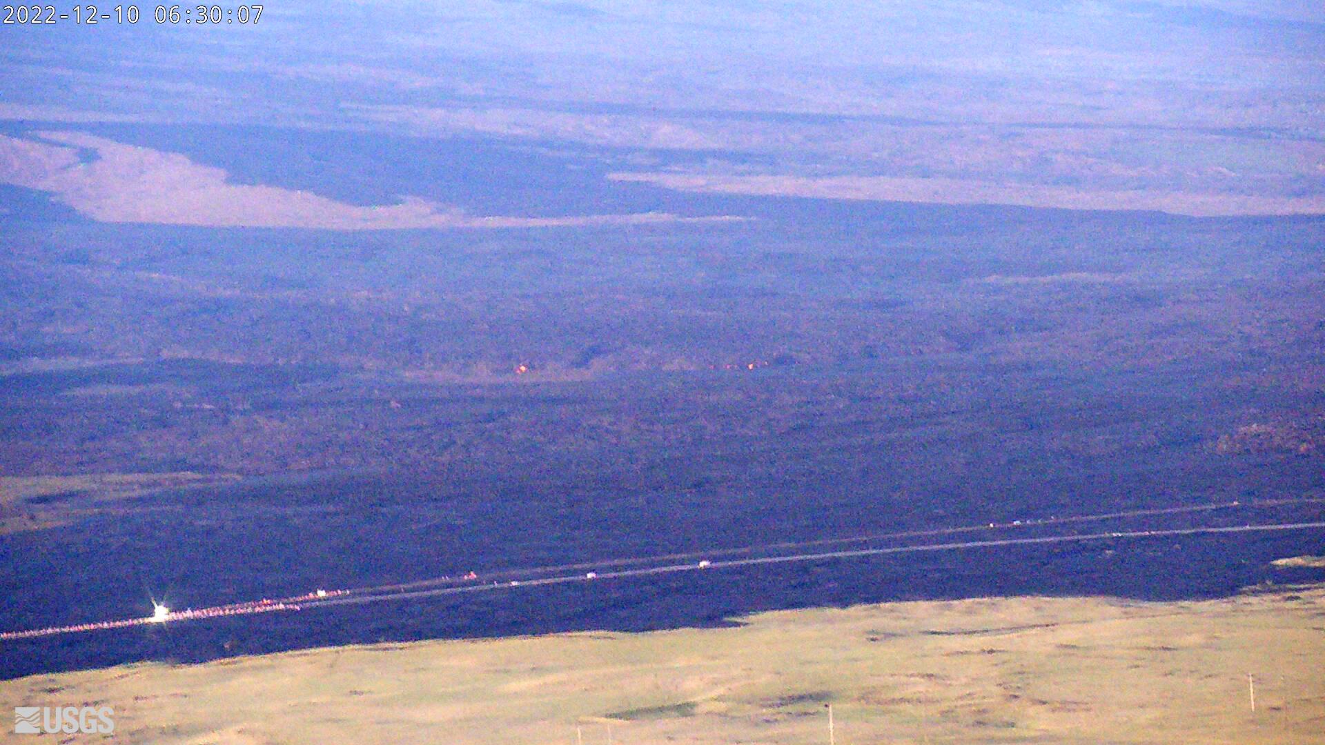 View of Mauna Loa from Mauna Kea at 6:30 AM HST
 -
12/13/2022:
From USGS: Mauna Loa is no longer erupting. Lava supply to the fissure 3 vent on the Northeast Rift Zone ceased on December 10 and sulfur dioxide emissions have decreased to near pre-eruption background levels. Volcanic tremor and earthquakes associated with the eruption are greatly diminished. Accordingly, the USGS Hawaiian Volcano Observatory (HVO) is lowering the Volcano Alert Level for ground-based hazards from WATCH to ADVISORY and the Aviation Color Code from ORANGE to YELLOW. HVO continues to closely monitor Mauna Loa for signs of renewed activity. Should volcanic activity change significantly a new Volcanic Activity Notice will be issued immediately.
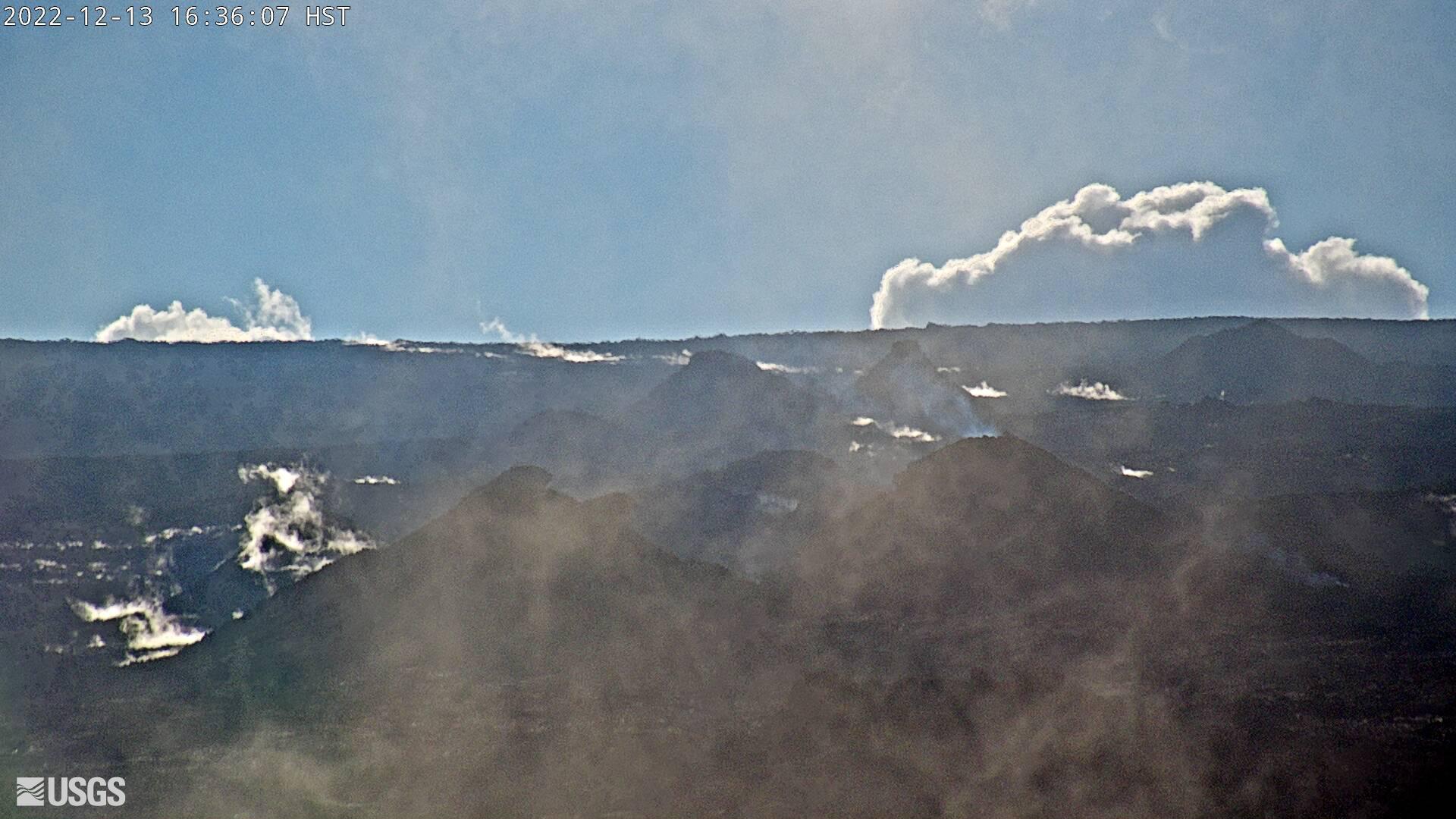 View of Mauna Loa fissure 3 from Mauna Kea at 16:36 HST
 -
12/21/2022:
A team from NOAA flew to the Mauna Loa observatory to assess conditions at the observing site and to estimate the length and height of lava covering the Mauna Loa access road. The facility looks to be in good shape. This picture was taken from the helicopter by the NOAA team; the Mauna Loa Solar Observatory is shown in red. It has snowed at the site, which is common in winter. The second photo shows lava flows from fissure 3 destroyed approximately a mile of the road and power lines. NOAA will be informed when the lava is cool enough for repairs to begin. Photos courtesy NOAA.
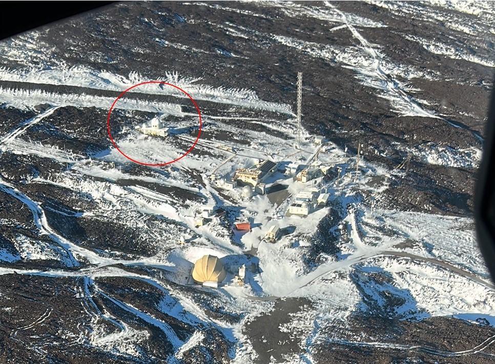 View of Mauna Loa Observatory site taken by helicopter (MLSO shown in red)
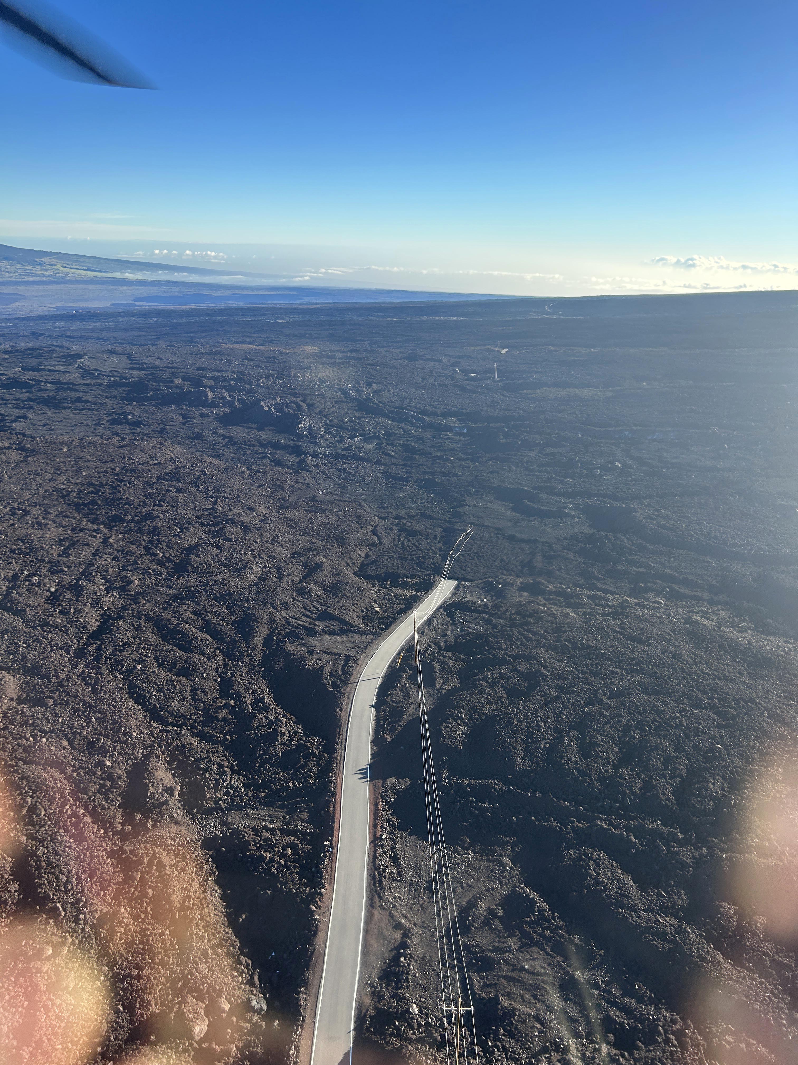 Lava flows from fissure 3 destroyed approximately a mile of the road and power lines
 -
12/28/2022:
NOAA visited the site by helicopter and reported very limited to zero ash fall at the site, which is great news. Paul Fukumura-Sawada from NOAA took these pictures inside the MLSO main dome showing the MLSO spar and floor. No sign of ash or damage is visible. Ben Berkey, HAO, will be visiting the site on Jan 4 for a more detailed inspection of the instruments and equipment.
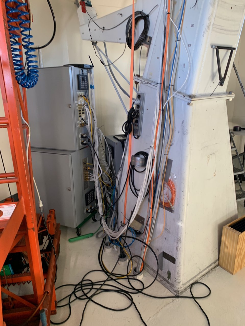 Base of MLSO pier showing little to no ash
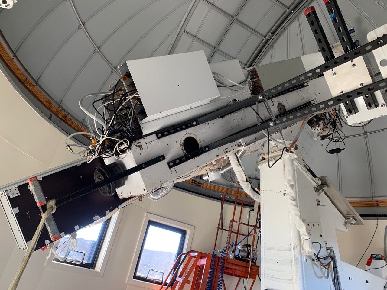 MLSO spar showing little to no ash
 -
1/4/2023:
MLSO site manager Ben Berkey joined NOAA staff in reaching the Mauna Loa site by helicopter to inspect the facilities and equipment. Ben made detailed inspections of MLSO and GONG facilities and equipment. He reported no apparent damage to any equipment and no volcanic ash deposits. The next step in reopening the facility requires the construction of a preliminary roadway on the ~mile long area where the lava flows destroyed the access road. USGS will notify NOAA when the lava is cool enough to the required depths for roadwork to safely begin.
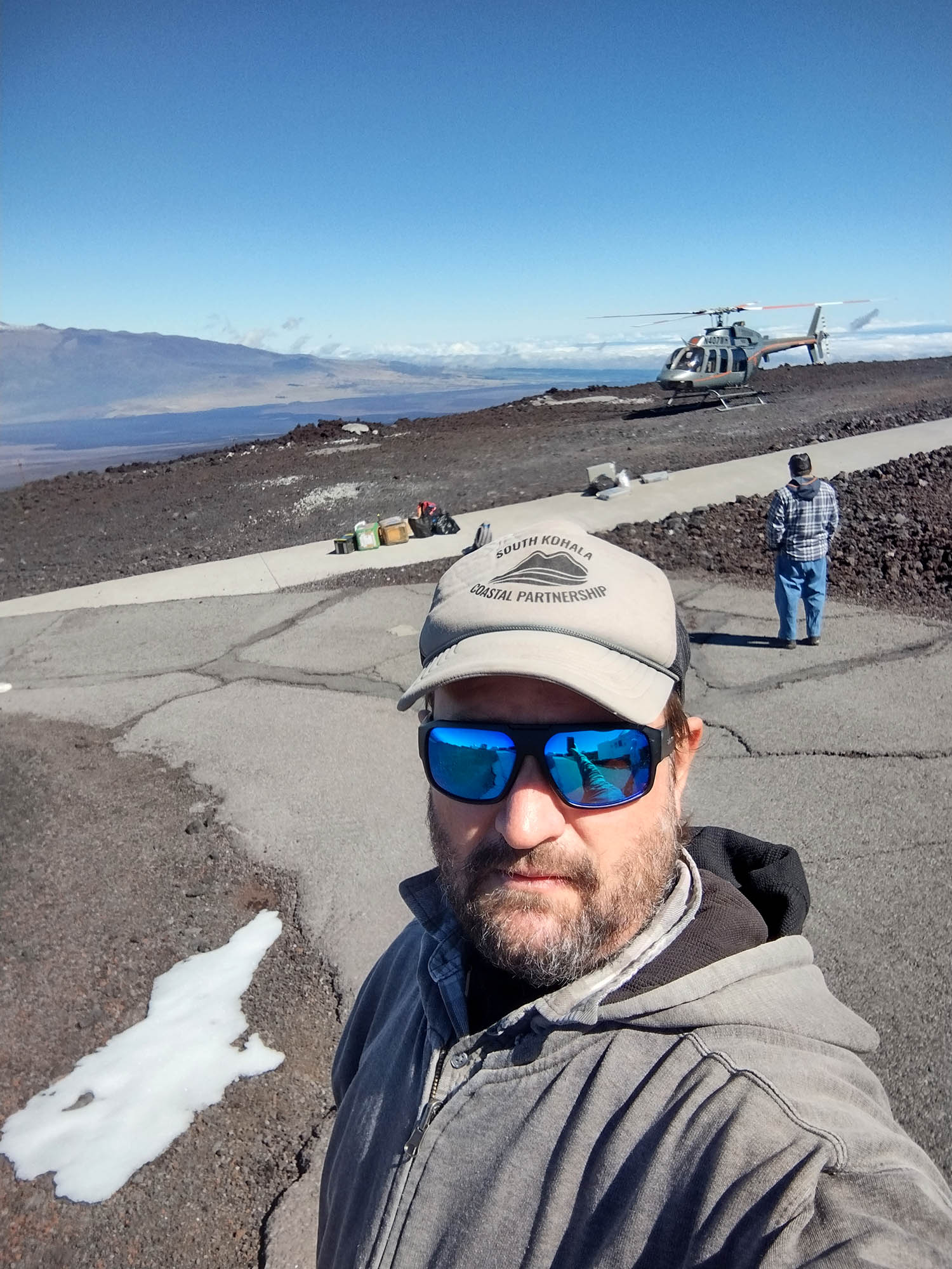 Ben Berkey and NOAA personnel arrive at the Mauna Loa Observatory (MLO)
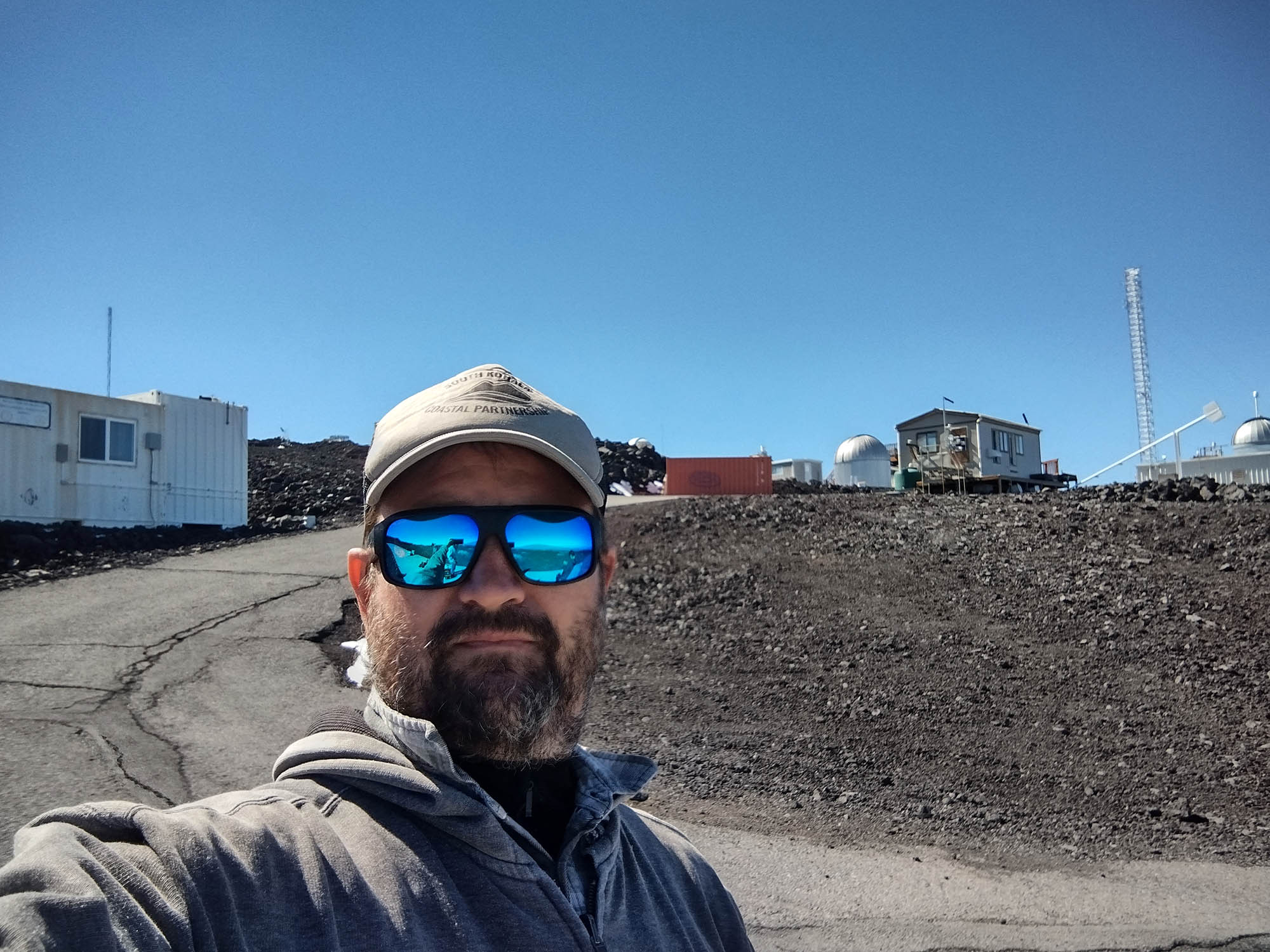 Ben Berkey at the MLO site with NOAA and GONG facilities in the background
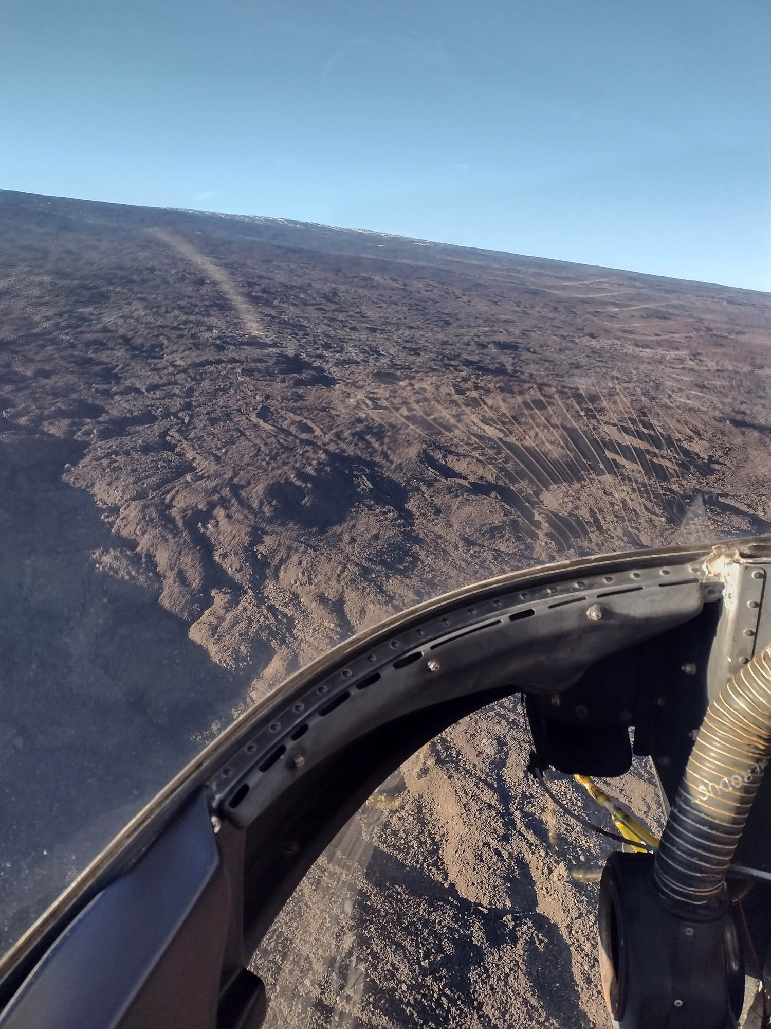 Helicopter view on the way to the MLO site
 -
3/7/2023:
We do not expect to reopen MLSO until May at the earliest. Over one mile of the Mauna Loa access road is covered by lava that has an average depth of ~30 feet. Power lines to the site were also destroyed. USGS has been measuring the temperature of the lava below the surface. At one meter depth the lava was hot enough to boil water and at two meters it was ~600 degrees F. Road work is not able to begin until the lava is cooler. NOAA is working with USGS and the state of Hawaii to construct short-term access to the site via a temporary road. The hope is that work on a temporary road can begin late April/early May. A temporary power supply to the site will also need to be constructed. We will provide more updates as we receive them.
-
10/18/2023:
NCAR facilities is working with HAO, NSF, the state of Hawaii, and NOAA on a solar panel power system for MLSO. NCAR is using NSF facility funds to purchase and install the solar panel array and batteries. NCAR’s design would provide sufficient power to operate and acquire observations during the April 8, 2024 total solar eclipse. All equipment and personnel will be transported to the site by helicopter. Construction of the solar panels is expected to take 6 to 8 weeks. Once a new interim access road is completed (June 2024), additional solar panels and batteries will be driven up to the site and installed. This additional solar power will provide long-term clean power to MLSO.
NOAA has acquired funds to install an interim access road. They are working with the state of Hawaii Dept. of Transportation. The new interim road is expected to be completed in June 2024.