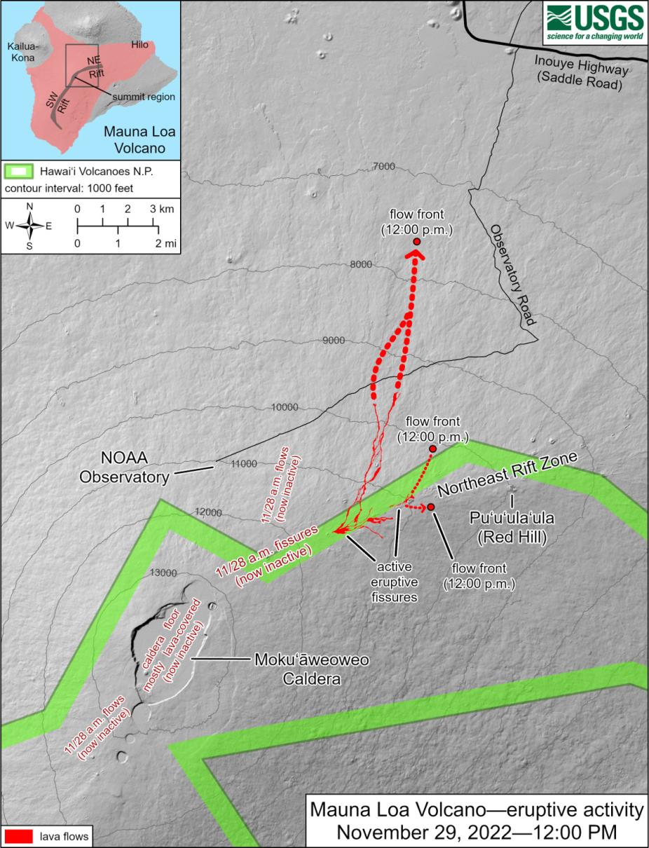
After 38 years, Hawaii's Mauna Loa erupted on Sunday 27 November 2022 at 11:30 PM local time. The eruption quickly filled the summit caldera forcing lava to spill and flow outward in an east and west direction. While the exact timing was a surprise, the eruption was anticipated due to recently felt earthquakes. Lava flows east of the Mauna Loa Solar Observatory (MLSO) have destroyed parts of the access road to the observatory and knocked out all power to the site. MLSO is not near any lava flows and not in any immediate danger.
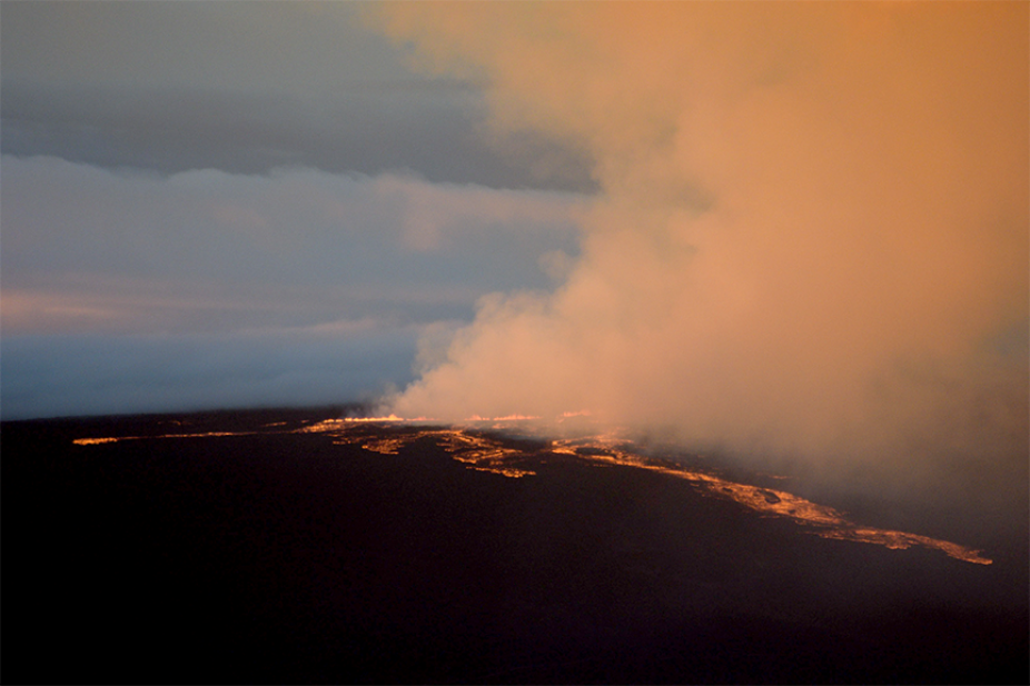
Captured 28 November at 6:00 AM local time from Mauna Kea looking south toward Mauna Loa showing lava spilling from the summit at ~13,500ft and flowing downward to about 12,000 ft.
Over the first few hours the eruption seemed to go through the following noted phases:
- 11:30 pm–2:00 am, filling the summit caldera.
- 2:00–4:00 am, spilling some lava toward the island's west side ~12,000 ft. above South Kona/Captain Cook bay.
- 4:00–8:00 am, lava flowing toward Hilo but remaining above ~12,000 ft.
- 8:00 am, a pausing/reduction of flow.
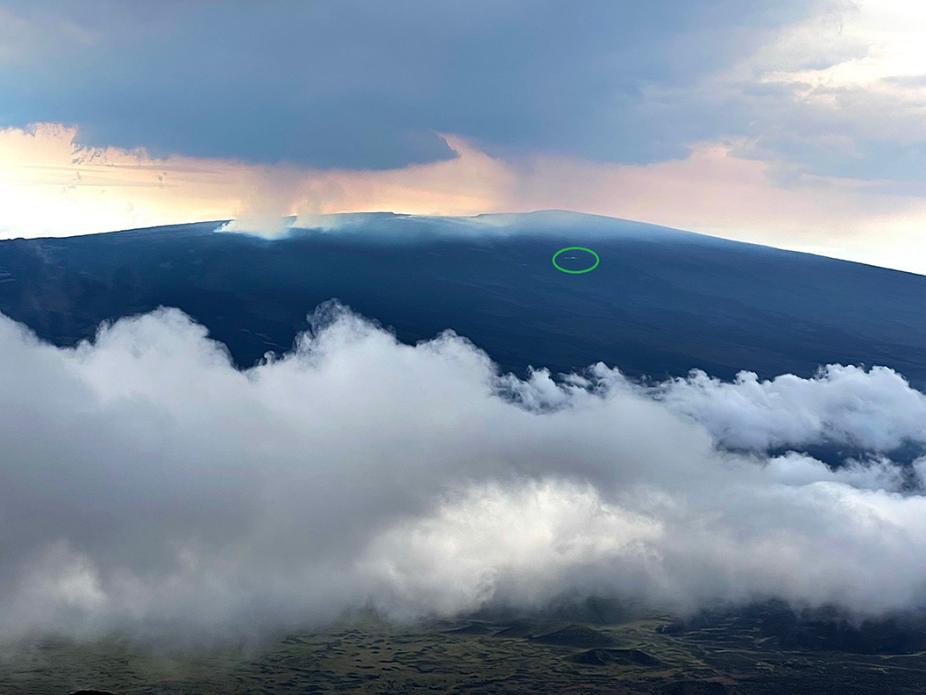
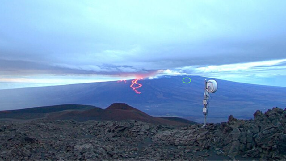
Captured 28 November at 9:00 AM a couple of thousand feet higher on Mauna Kea showing the eruption is slowing. At that time we no longer see any incandescence in the flow, but gas clouds outlining the flows are visible toward the left side of the image. The Mauna Loa observatory, including MLSO, is highlighted in the green circle toward the right side of the mountain. Not visible in this picture, is the MLSO access road and power lines that lead from the green circle to the left side of the picture to a point a little below where the foreground cloud intersects the side of the frame.
On the evening of 29 November Ben Berkey noticed the power at the observatory had switched to the battery backup system known as an Uninterruptible Power Supply (UPS) indicating a power outage at the site. UPS provides power to the observatory for multiple hours but cannot sustain power for longer. Hawaii Electric confirmed that the lava flows had knocked out power to the Mauna Loa site as well as to other users. The significant lava flow has damaged or destroyed power lines as well as parts of the Mauna Loa access road. Prior to losing power, the MLSO sky web cam and the NOAA web cam were recording images from the site. The lava has continued flowing downward to an altitude of about 7,500 ft. The MLSO site is not in any immediate danger but has no power and no road access. Repairs to the road and power lines cannot begin until the lava flows have stopped. We anticipate MLSO to be closed for at least several weeks.
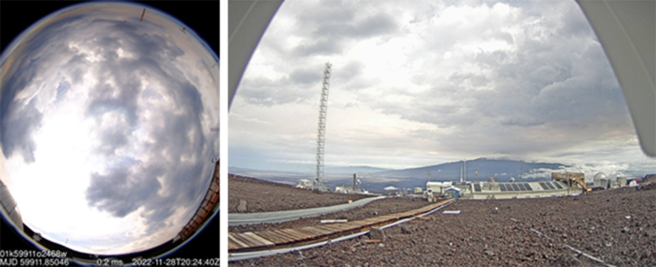
The MLSO sky web cam, left, on 28 November at 10:24 Hawaii time (20:24 UT) showing clouds with some red smoky haze due to the eruption. 28 November at 08:25 AM Hawaii time, right, from the NOAA north cam located at the MLSO building and looking toward Mauna Kea showing the reddish smoky clouds to the southeast where the lava flows are more active. The Mauna Loa summit is located behind where the web cam is pointing. Due to the current power outage these webcams are no longer operating.
Unfortunately, eruptions in Hawaii can continue for weeks to months with periodic renewed activity and lava flows can be dynamic and unpredictable. Meanwhile, we are thankful that our staff, NOAA staff, and all other Mauna Loa personnel and local residents are safe.
We will continue to post updates on the situation on our MLSO home page.
Captured 29 November at 06:36 AM Hawaiian time, lava continues to flow down the mountain. These flows crossed the Mauna Loa access road destroying those sections and the power lines that run parallel to the road. The green circle in the image indicates the approximate location of MLSO.
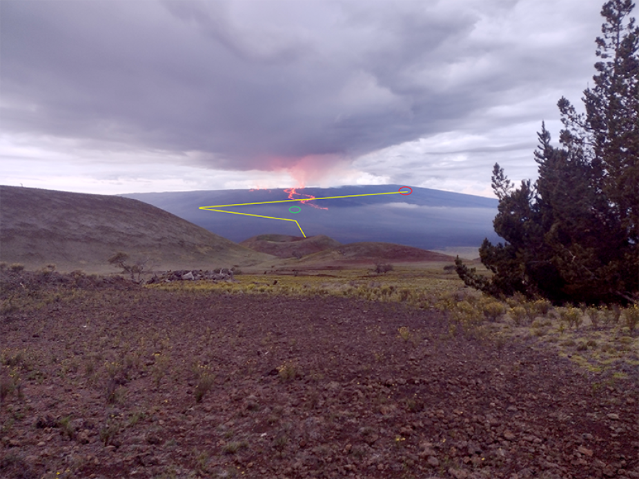
Captured from Mauna Kea showing lava flows and annotated with path of Mauna Loa access road (yellow) to MLSO (red circle) and site of Hi-Seas Mars Habitat (green circle).