The McIntosh Archive of Synoptic Maps (McA)
In 1964, Patrick McIntosh, a scientist at NOAA’s Space Environment Center in Boulder, CO, began creating hand-drawn synoptic maps of solar magnetic features. In all, he compiled ~45 years or nearly four complete solar sunspot cycles of maps, representing a unique record of the large-scale organization and variation of the Sun’s magnetic field. In 2011 Pat’s life’s work was at risk of being lost. Although versions of the maps were archived in scanned format at the NOAA National Centers for Environmental Information (NCEI), many maps only existed in hard-copy format in boxes, and none of the scanned maps possessed metadata allowing digital search and analysis. Updated with maps of SC24.

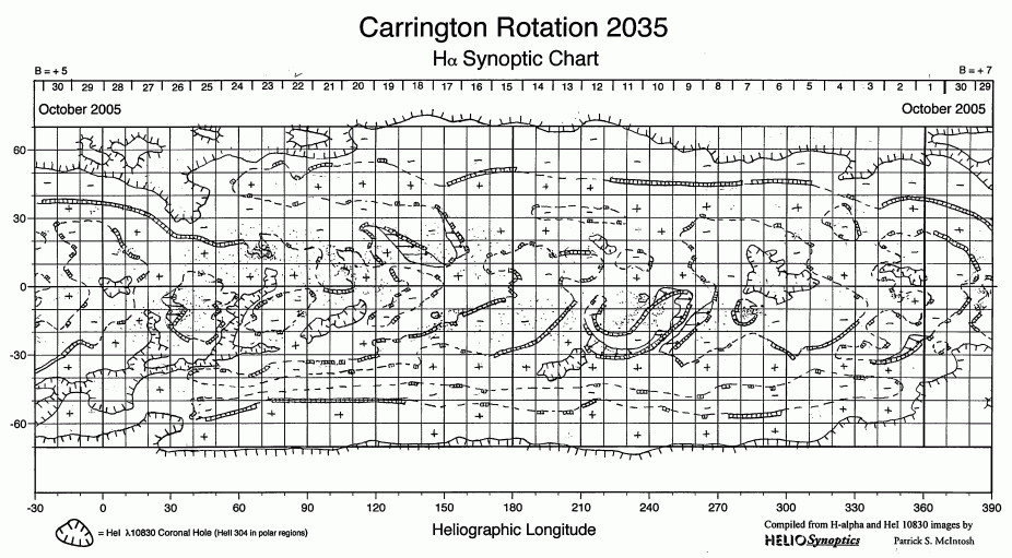
Example of original, hand-drawn McIntosh Archive (McA) synoptic solar map -- vertical axis is solar latitude (from South to North pole) and horizontal axis is solar longitude (representing one solar Carrington rotation of approximately 27 days).

The map after processing. Magnetic features are identified with a distinct color, as described in legend.
Luckily an NSF Rapid grant enabled its digitization, and now the digital archive is complete. The intent of the McIntosh Archive (McA) project (a Boston College/NOAA/NCAR collaboration, funded by the NSF) was first and foremost to preserve the archive in its entirety, by completing the scanning of all of the maps. Beyond this, a procedure has been designed and implemented to standardize the size and orientation of the digital maps, to remove any unnecessary notes, marks or symbols, and to colorize the maps so that each magnetic feature is uniquely searchable. We have also digitized and included with the McA, SC19 by Makarov and Sivaramen using Kodaikanal data. Final versions of the maps have been archived at NOAA/NCEI (direct link to data here).
Pat passed away on October 16th 2016 at the age of 75.
Data Citation
Patrick S. McIntosh, NOAA Space Environment Laboratory (1964). Synoptic Maps Composites Observed from McIntosh. NOAA National Centers for Environmental Information. doi:10.7289/V5765CCQ [access date]