Yellow Jacket
Yellow Jacket, in Southwestern Colorado, is the largest of a group of ruins distributed over the Montezuma basin. The regional population probably reached 30,000 at its peak in the 12th century.
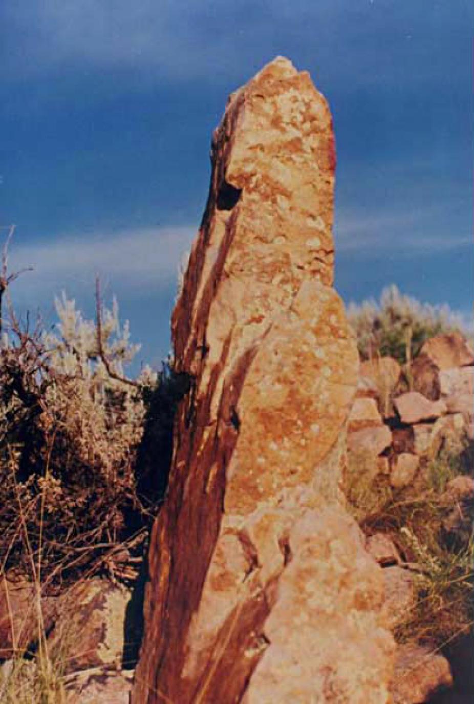
Monolith at Yellow Jacket possibly used for a solar calendar.
The ancient town of Yellow Jacket itself was home to some 2500 people. The town is located atop a mesa oriented roughly North-South and overlooking Yellow Jacket creek. Unlike the large pueblos of Chaco Canyon or the cliff houses of Mesa Verde, Yellow Jacket and other contemporary Montezuma basin towns consist of a large number of small multi-room dwelling sites spread over a relatively large area. The rock monolith shown in the image is located at the southern end of the town. Its flat, straight and elongated upper edge is aligned approximately towards the North-East, and in the weeks preceding and following summer solstice would have cast a sharply pointed shadow on the outer wall of a building located immediately West of the monolith. This opens the possibility of using this outer wall to define a solar calendar, although direct evidence will always be lacking because the crucial wall has long since collapsed and now lays in ruin. Other examples for the use of shadows cast on external building walls to define a calendar have been suggested in the area, notably at Cajon ruin in Hovenweep.
Four additional monoliths of size comparable to the one shown on the slide are found in the immediate vicinity, although these are no longer standing. Given their present location, It is plausible that all five monoliths were once standing and aligned in such a way as to indicate the azimuth of summer solstice. Megalithic alignments are certainly not a common feature in the ancient American Southwest, although they are relatively common astronomical devices in other parts of the world (Stonehenge being perhaps the archetypical example).
At Yellow Jacket the use of such devices is certainly not necessary for calendrical purposes, since the eastern horizon as seen from the site is clearly suitable for the establishment of an horizon calendar, including anticipatory observations of the summer solstice (see slide 4, horizon calendars). While the site remains un-excavated, the ruins currently visible offer considerable evidence that the builders of Yellow Jacket went out of their way to locate their buildings and shrines along azimuthal lines of astronomical significance, in a manner reminiscent of many well-studied ancient Mesoamerican cities. For example kivas, found in unusually large numbers at Yellow Jacket, are often grouped in lines approximately aligned with the East-West equinox azimuth. Many other alignments have been identified, involving shrines, great kivas, prominent building such as towers, and even the monoliths. Admittedly, given enough buildings, kivas and monoliths, astronomically interesting alignment are bound to arise if only by chance. Yet it is very likely that many of the alignments present at Yellow Jacket were intentional, and might have been meant to reflect, in the design of the town itself, the structure of the Anasazi cosmos.