SMM Coronal Synoptic Maps
Synoptic Maps from the SMM mission are available for 1980 and 1984-1989 in GIF format (NOTE: No observations were taken during 1981-1983).
Access
Access to the SMM coronal synoptic maps is available via the links provided below. The maps are organized by year.
What Is a Coronal Synoptic Map?
A synoptic map is a plot of the brightness in the corona as a function of latitude and longitude. Each plot consists of scans taken at a particular height in the corona above both limbs.
Each east limb scan is then vertically lined up with the corresponding west limb scan taken ~13 days later so that the same coronal longitude may be seen simultaneously on both limbs. This makes it possible to visualize the structure of the corona.
Time runs from right to left as data is plotted on a synoptic map (due to the nature of the rotation of the Sun), and the scans are taken from observations taken at approximately half-day intervals. Click on the images below for a closer look at the synoptic maps. The first map was generated during solar maximum (1980), while the second one was during solar minimum (1986).
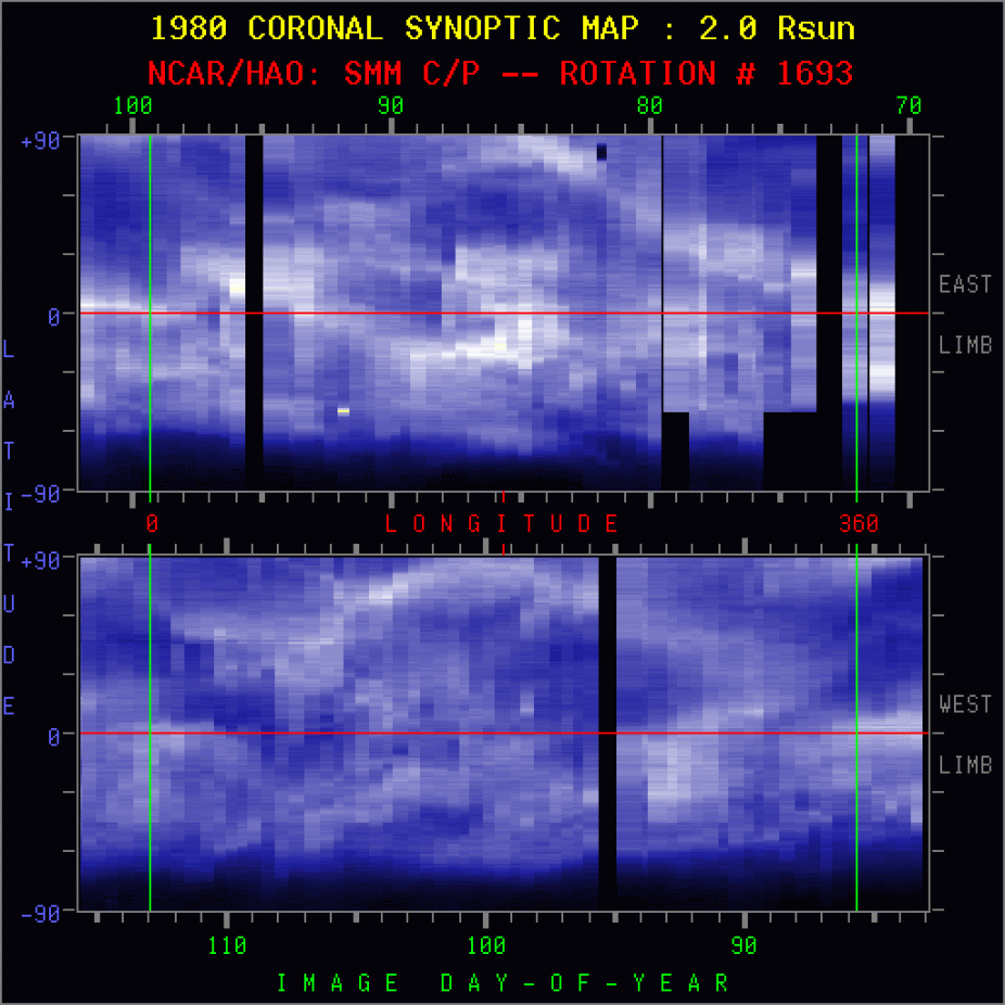
SMM synoptic map for CR1693 at 2.0 solar radii.
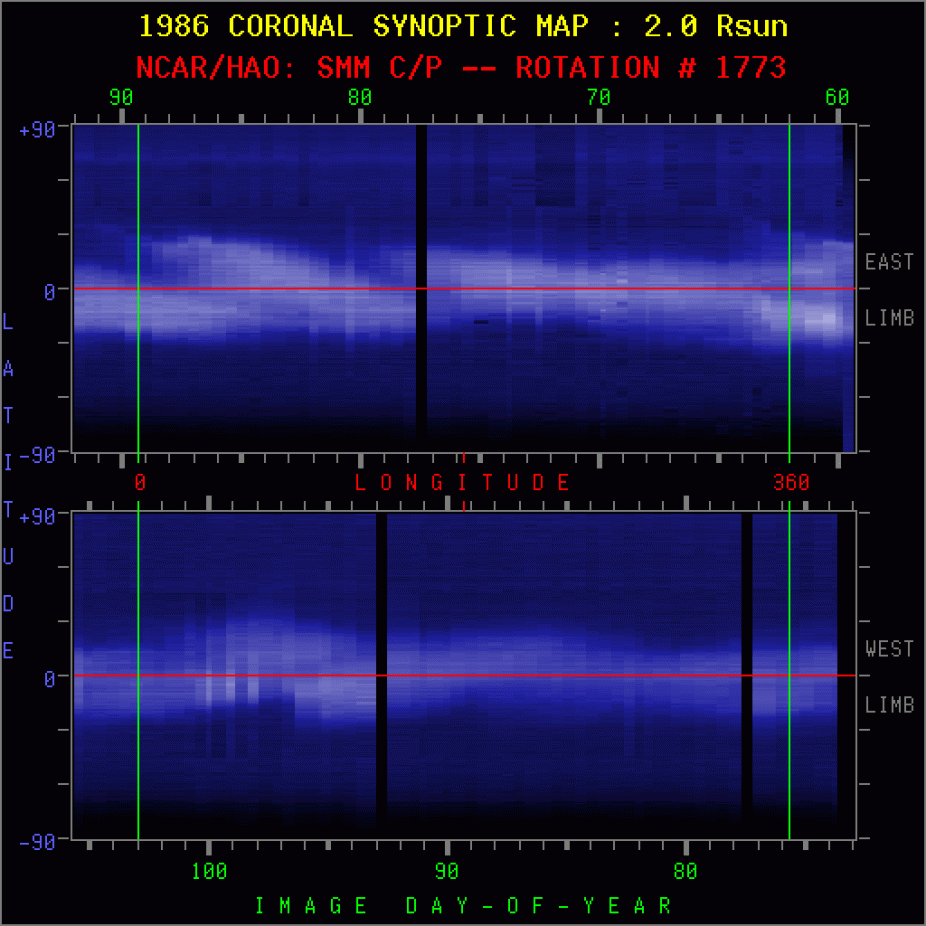
SMM synoptic map for CR1773 at 2.0 solar radii.
The synoptic maps shown above were both taken at 2.0 solar radii. SMM coronal maps are generated at 2.0, 2.8, and 3.4 solar radii. The two examples above are taken for one Carrington Rotation, which is one full rotation of the sun. In addition to having maps which contain only one Carrington Rotation, there are also maps which span several Carrington Rotations.
How Are Coronal Synoptic Maps Used?
These maps are used to view the structure of the corona, and to detect any changes in that structure. For example, CMEs (Coronal Mass Ejections) can sometimes be detected in Coronal Synoptic Maps. In fact, each of the single rotation maps may be paired with a corresponding map that contains markings to show where CMEs have occurred (see a sample pair below).
SMM synoptic map for CR1693 at 2.0 solar radii.

SMM synoptic map for CR1810 marked with CMEs.
Synoptic maps may also be used to see patterns in the evolution of the Sun's streamers. During solar minimum, the streamers are concentrated near the equator, while closer to solar maximum, streamers are spread across all latitudes.
The synoptic maps have also been helpful in the analysis of CME occurrences. For example, there is an observable spread in mass ejection latitudes during the 1987-1989 period of rising solar activity, reflecting the pattern of the helmet streamers. This suggests that CMEs are closely related to areas of closed magnetic fields (helmet streamers). A closer examination of the synoptic maps for 1984 will help to demonstrate this, as well as other patterns.
An Examination of 1984 Synoptic Maps
The coronal synoptic maps for 1984 are revealing in the following ways:
They show features that correspond to a tilted dipole configuration. For example, there are large regions of low coronal brightness (coronal holes) in both hemispheres, separated by a continuous band of high coronal brightness which encircles the Sun as a sinusoidal wave near the equator. This band is identified with a belt of coronal helmet streamers. See the map below:
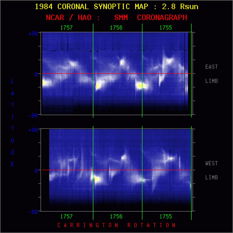
SMM synoptic map showing tilted dipole.
The maps with marked CMEs for this year demonstrate that most of the mass ejections occurred along the band of high coronal brightness identified with the "magnetic equator" in the tilted dipole system, reinforcing the idea that they emerge above the belt of helmet streamers and closed magnetic field lines.
The maps with marked CMEs also show an interesting feature near the occurrences of CMEs, namely a tendency for the coronal band to be exceptionally bright just to the right of many ejections and extremely dim (almost non-existent) to the left of the ejections. This characteristic is more apparent in the maps generated at greater heights. The flaring out in latitude and the sharp disappearance of the bright coronal band gives each of these features the appearance of a "bugle" facing to the left (see map below). The "bugles" represent a swelling of the belt of helmet streamers for several days before the occurrence of a mass ejection.
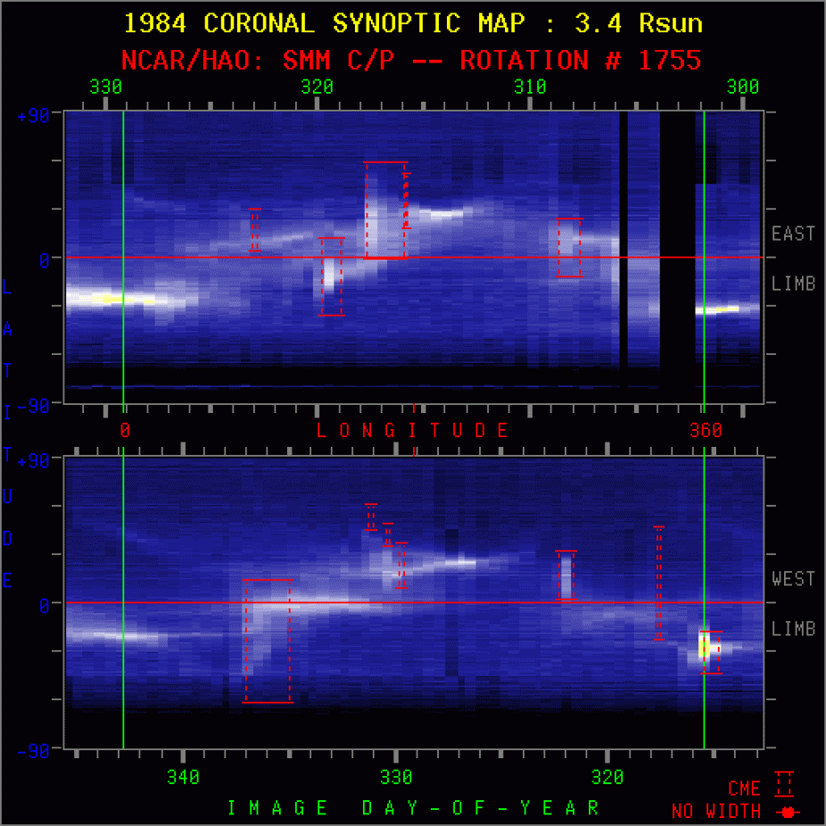
SMM synoptic map marked with CMEs.
SMM Data Use Policy
The use of SMM C/P images for public education efforts and non-commercial purposes is strongly encouraged and requires no expressed authorization. However, it is requested that any such use properly attributes the source of the images as: "Courtesy of HAO/SMM C/P project team & NASA. HAO is a division of the National Center for Atmospheric Research, which is supported by the National Science Foundation."
Acknowledgements
The Solar Maximum Mission Coronagraph/Polarimenter was designed & operated by the High Altitude Observatory, a division of the National Center for Atmospheric Research, and funded by the National Science Foundation. The SMM Coronagraph/Polarimeter instrument was built by Ball Aerospace Systems Division. The SMM Spacecraft was built by Goddard Space Flight Center, and the SMM project was funded & managed by the National Aeronautics & Space Administration.